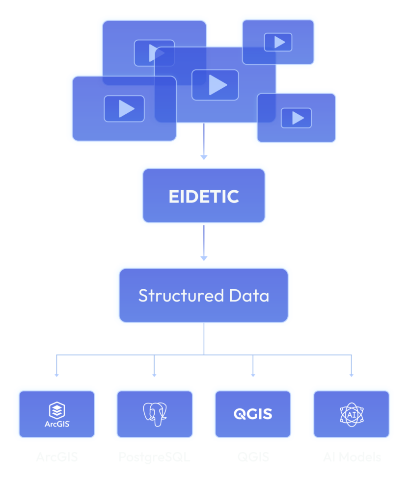
Eidetic converts ordinary imagery into structured, high-value data for AI, analytics, and operational decision-making.
Designed to run locally, there is no server farm or cloud required, conversion takes place right on a laptop.
Data from Eidetic can go directly to data infrastructure and analytics technologies.
Better Data
Smarter Decisions
Stronger AI
Accelerated Growth
Video to Structured Data
Eidetic data is so strong and accurate, the original video can be deleted and recreated from scratch.
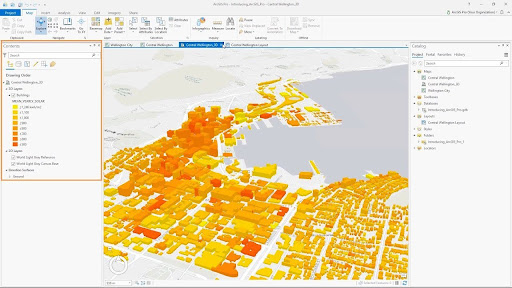
GEOSPATIAL PLATFORM
ArcGIS
Eidetic integrates directly with the industry-leading proprietary geographic information system (GIS) platform allowing for the creation, analysis, mapping, and sharing of geospatial data.
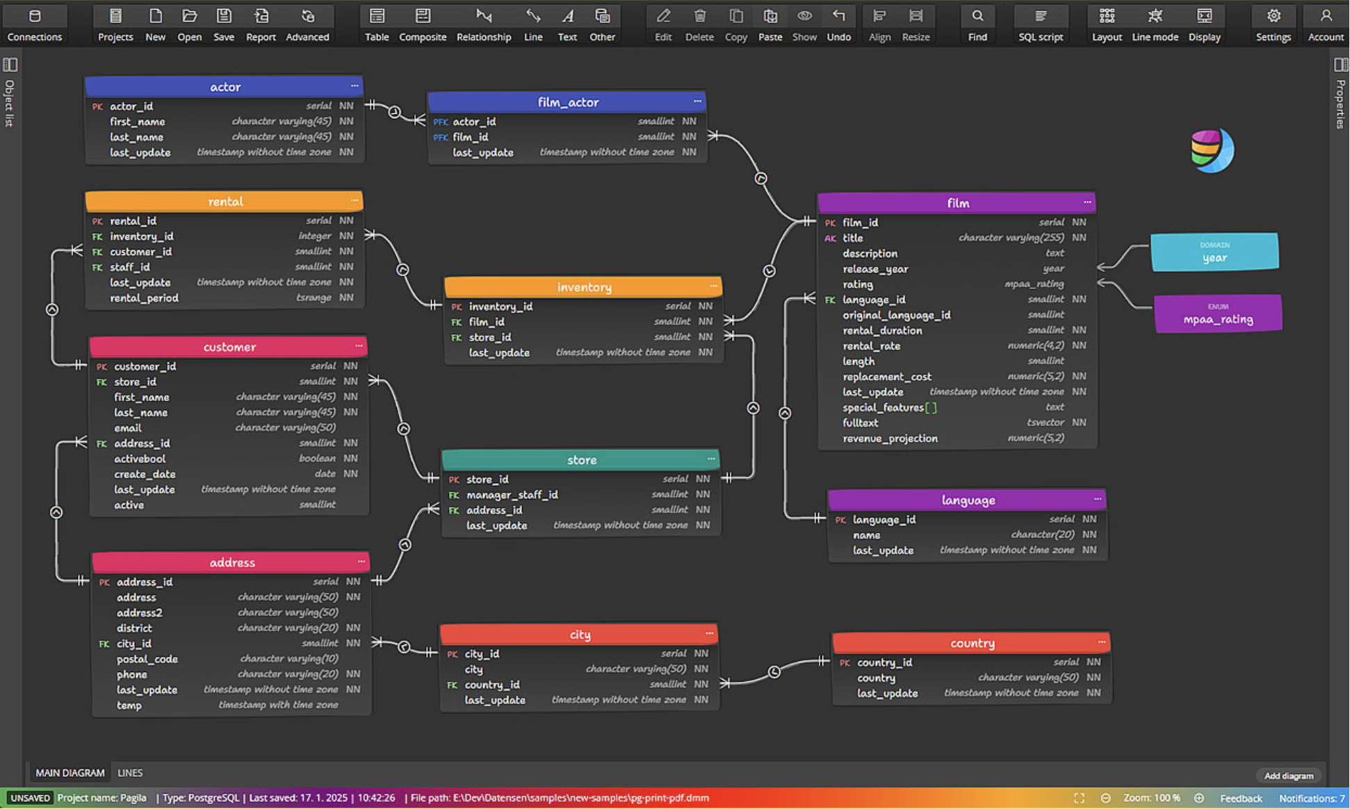
DATA INFRASTRUCTURE
PostgreSQL
PostgreSQL is a powerful, open-source object-relational database system known for its reliability, data integrity, and extensibility, used to store and manage complex data for applications like web, mobile, analytics, and geospatial services. It’s used because it offers advanced features, supports both relational (SQL) and non-relational (JSON) data, ensures data reliability through ACID compliance, and runs on nearly all operating systems, making it a robust choice for demanding workloads.
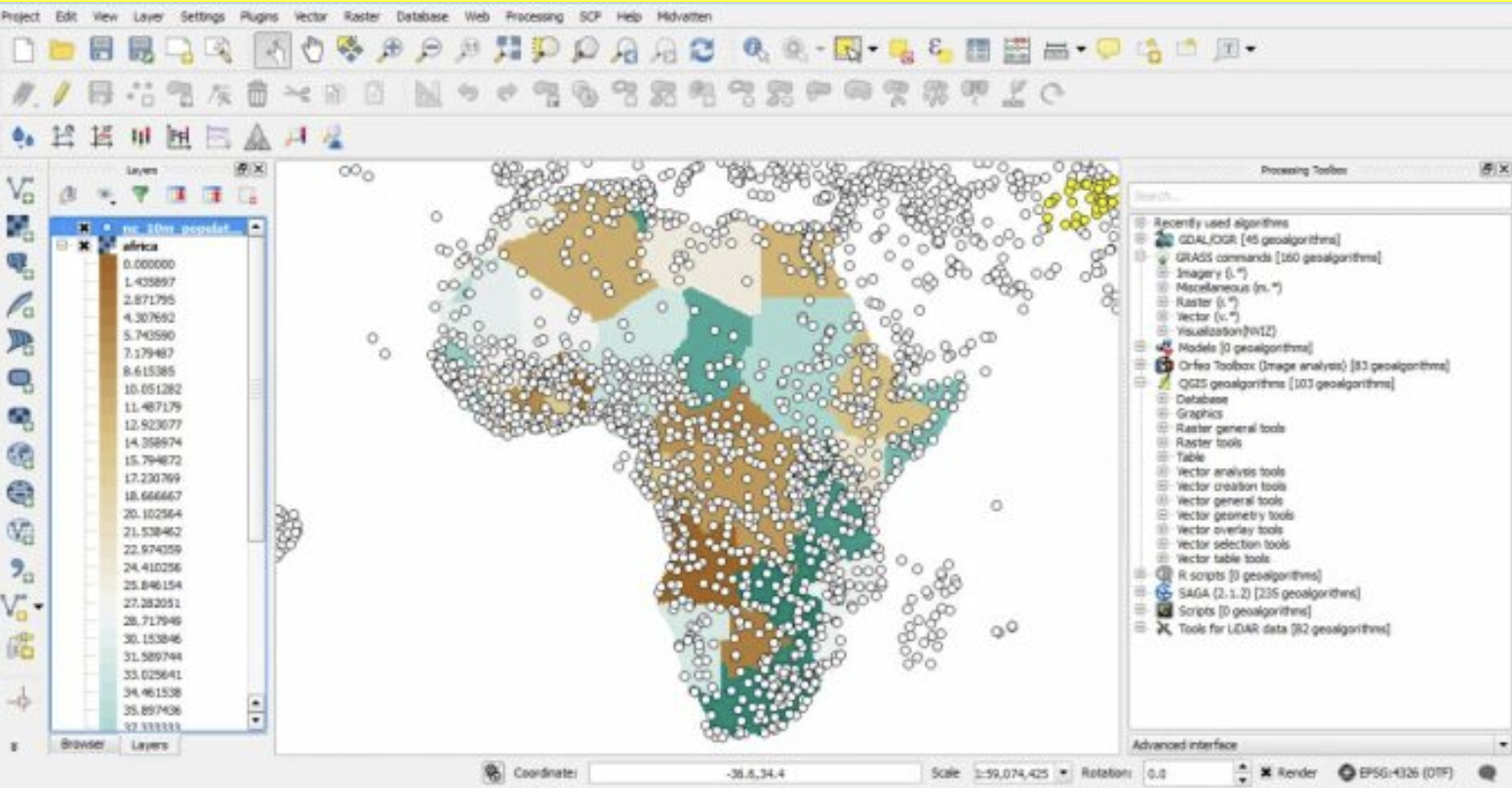
OPEN SOURCE GIS
QGIS
QGIS is a free, open-source software used for creating, editing, analyzing, visualizing, and publishing geospatial data, allowing users to create interactive maps, perform spatial analysis (like network or environmental), manage geographic information, and process data for various fields from urban planning to environmental science. It’s a powerful tool for anyone needing to work with maps and location-based data, functioning as an alternative to proprietary GIS software like ArcGIS.
AI DETECTION MODEL
YOLOv12
YOLOv12 is able to detect objects in real-time, making it suitable for applications such as video surveillance or self-driving cars.
YOLO achieves high accuracy by using a convolutional neural network (CNN) to predict both the class and location of objects in an image.
Combined with EIDETIC, YOLO provides a powerful or training AI.